RuG/L04 is software for dialectometrics and cartography.
And more.
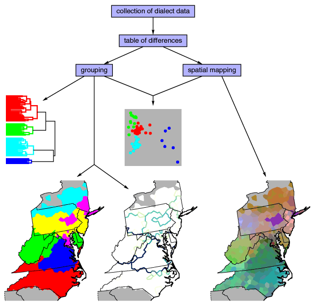
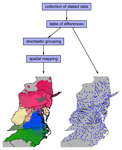
In plain text: in several locations in some area, you collected the local
variants of the pronunciation of a large number of words. Using
RuG/L04, you can compare these words, and make dialect
maps of the results.
You start with making a distance table. You construct a table that has for each
pair of locations a number that expresses how much words differ
between those two locations. For each word, the variant forms of the
two locations are compared, and the final difference between the two
locations is the average of all variant differences.
There are several measurements to express numerically the difference between
two words. One measurement is the
Levenshtein distance
(or string edit distance
or edit distance for short).
Another measurement is the
Gewichteter
Identitätswert or G.I.W.
You do some processing on the difference table. You make a group partitioning
using
clustering,
or a spatial distribution by means of
multidimensional scaling.
With the result you draw a dialect map.
RuG/L04 is a collection of stand-alone programs.
Each program performs a single step in the processing sequence. This means that you can
use the programs independently, and apply them to other tasks. For example, you
could make maps of genetic differences, if you have obtained a table of genetic
differences between locations, using software not included in the current package.
The rubrical index of the manual gives an overview of
all available programs.
Apart from the stand-alone programs, there is an
R library.
R is a powerful statistics system, freely available for each computer platform.
Using the library, you can import and export data in a format that is used by the
other software, and use R for analysis and further processing of the data.